Working with our free maps and pictures can greatly enrich high school World History students' understanding of the growth of English parliamentary democracy from the 13th to the 20th century. Visual resources help students place key events in a geographic and historical context, making abstract political developments more concrete and relatable.
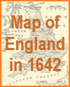
Maps, for example, can show the evolution of England's political boundaries, the locations of important events like the signing of the Magna Carta or the Glorious Revolution, and how the balance of power shifted over time. By seeing where events happened, students can better understand the strategic importance of places like Westminster, London, and various battle sites that shaped political outcomes.
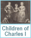
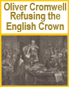
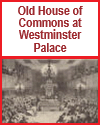
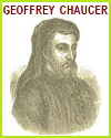
Pictures and illustrations--such as depictions of the Model Parliament of 1295, portraits of monarchs and reformers, and images of the Houses of Parliament--allow students to connect faces and architecture with historical narratives. Political cartoons and visual representations of parliamentary sessions can also spark discussion and analysis of how democracy was perceived and practiced in different eras.
Using maps and images supports visual learners, encourages critical thinking, and helps students synthesize complex historical changes. Overall, these tools provide a richer, more engaging way to explore the development of representative government in England.
|