


| Brandenburg Prussia Map |
|---|
| www.studenthandouts.com ↣ World History ↣ Rise of European Nation-states ↣ Maps & Pictures of the Rise of Nation-states |
 |
|
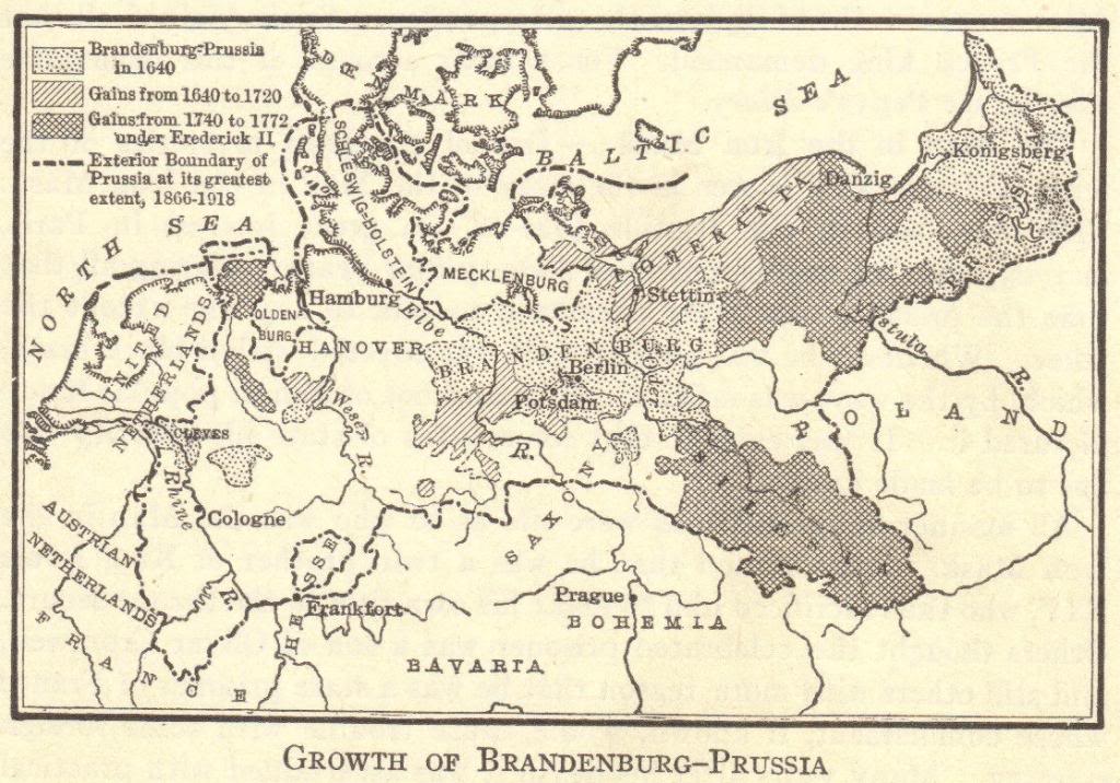
Map of the growth of Brandenburg-Prussia (unification of Germany), indicating Brandenburg-Prussia in 1640, the gains between 1640 and 1720, the gains from 1740 to 1772 (under Frederick II), and the exterior boundary of Prussia at its greatest extent (1866-1918). Click here to enlarge. |
 |  |  |  |  Biography Workbook") |  |
| www.studenthandouts.com ↣ World History ↣ Rise of European Nation-states ↣ Maps & Pictures of the Rise of Nation-states |


