
| Map of Europe in 814 C.E. |
|---|
| www.studenthandouts.com ↣ World History ↣ European Middle Ages ↣ Medieval Maps & Pictures |
 |
|
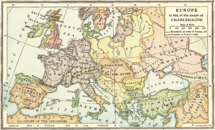
Map of Europe in 814, at the Death of Charlemagne
This map illustrates the extent reached by Charlemagne's empire by the time of his death in 814 C.E. Also indicated are the boundaries set by the Treaty of Verdun in 843 C.E., as well as the boundary of modernFrance in 1920 (following World War I). Charlemagne's reach extended further east than does modern France, most notably into areas of today's northern Italy, Switzerland, and Germany. Click here to enlarge this image. |
 |  |  |  |  |  |
| Middle Ages Books and Films | Middle Ages Outlines and PowerPoints |
| Middle Ages Maps and Pictures | Middle Ages Study Games |
| Middle Ages Miscellany | Middle Ages Printable Worksheets |
| www.studenthandouts.com ↣ World History ↣ European Middle Ages ↣ Medieval Maps & Pictures |