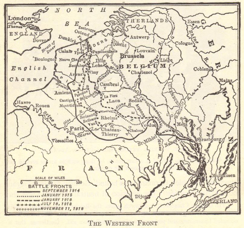
Map of the Western Front in World War I: The battle lines, stretching across Belgium and France between 1914 and 1918, can be clearly seen.
The Western Front, the primary theatre of World War I, was defined by a brutal stalemate of trench warfare. Following the failure of the German Schlieffen Plan in late 1914, a static line of fortified trenches stretched over 400 miles from the Swiss border to the North Sea. This landscape became a nightmarish world of mud, shell craters, and barbed wire.
Life for soldiers was horrific, dominated by artillery barrages, sniper fire, disease, and the constant threat of death. Attempts to break the deadlock resulted in colossal, futile battles of attrition like Verdun and the Somme in 1916, where millions were sacrificed for minimal territorial gain. The introduction of new technology, such as tanks and improved tactics in 1918, finally restored mobility.
The Allied Hundred Days Offensive ultimately pushed the exhausted German forces back, leading to the Armistice in November 1918, but at a staggering cost of millions of casualties on both sides.
|


")


